

With a Master’s in Mechanical Engineering, and a PhD in Ocean Wave Energy and Ocean Engineering, CEO Dr. Scott Beatty’s decision to establish MarineLabs Data Systems Inc. – real-time coastal intelligence for marine domain awareness – was the logical next step in a career focused on ocean engineering and wave energy research. “After University, I consulted for organizations that were interested in converting waves to energy — for example, the U.S. Department of Energy,” said Beatty. “It didn’t take long for me to realize that there was a significant lack of data that could assist in ship and maritime safety as well as for validation of predictive modelling of climate change impacts.”
Possessing both the vision and the skills, Beatty set about creating the core technology that monitors wind and waves with solar-powered sensors mounted on buoys and Aids to Navigation (AtoN). Enter an exceptional team of software and engineering leaders, including a few former NASA staff – and MarineLabs with their CoastAwareTM product was born.
The technology
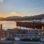
The ability to measure wind and wave action is a technology that has been advancing over many years. “Most measurement buoys in the past were designed to be these super rugged, huge pieces of equipment with satellite connectivity that can be placed anywhere in the ocean,” Beatty said. “But 90 per cent of shipping is within a 10 kilometre-radius off the coast, requiring nothing more than cell coverage.” This was the starting point for MarineLabs – to be able to capture more data, at higher resolutions, with much more frequency than traditional weather monitors and accessible by anyone with an internet connection.
The hardware – CoastScoutTM – is a sensor that can be mounted on buoys and transmit every wave and every gust of wind to the cloud where the data is accumulated and accessed by clients through a subscription-based account with a simple user interface that can be standardized and fed into any system, whether it be for web, mobile or even integrated into an existing API (application program interface).
At present, MarineLabs has sensors installed in buoys in Nova Scotia, San Diego, and the span of the Canadian West Coast, from Victoria to Prince Rupert. Given that there are over 10,000 buoys in Canada, and over 65,000 in the U.S., MarineLabs is able to use these existing aids to navigation through developing relationships with Coast Guards. “Both the Canadian Coast Guard and the U.S. Coast Guard see the benefit of real-time data that can greatly enhance decision making, especially for operations like rescue missions. Through agreements to exchange data in return for permission to install CoastScoutTM sensors on Coast Guard buoys, we’re able to achieve a wide coverage of the coast,” Beatty said, adding that each sensor is calibrated to account for the unique “bobbing” characteristics of each buoy.
A better mousetrap
The appeal of CoastAwareTM for organizations like ports, pilots, government, and research agencies cannot be understated. Most notably, as a subscription-based service, clients are not burdened with maintenance costs. The ability to receive real-time information in high resolution (as much as four times faster than traditional government weather services) is especially useful for pilots trying to make a go/no-go decision for service or for ports managing just-in-time arrivals.
The value of CoastAwareTM for ports is equally enticing. “Many ports are moving toward real-time or predictive modelling for issues like tides for dynamic under-keel clearance,” said Beatty. “CoastAwareTM is a powerful tool that allows them to plug in data that validates the modelling.” Indeed, MarineLabs is currently working on an interface that will have the ability to integrate the predictive modelling with real-time data, allowing port managers to see where true measurements are falling outside of the scope of models.
Clients with coastal engineering requirements are also seeing the benefit of being able to draw on historical data that can be used to consider climate resilience and a greater understanding of the impact of sea level rise. “For example, BC Ferries has been using some of our data to analyze a location where they are planning berth upgrades,” said Beatty. National governments and environmental non-government organizations have also expressed interest in this type of information.
The future
As noted above in the example of ports focusing more and more on predictive modelling, MarineLabs is continually working on advances that serve to increase value and usefulness of the information. “Our overarching vision is to have a sensor on every buoy maintained by Coast Guards to allow for optimized coverage of the coast,” Beatty said, adding that they are also working with customers who have a need to monitor inland waters. “Each port, and each customer, has a different set of needs – whether it is a marina on a lake, or a national government focused on hurricane activity — and our ability to meet those needs continues to be borne out.”
New developments in sensor technology are providing more opportunities for new features to be incorporated into the CoastScoutTM sensors such as fog sensors and wake attributions from ships that can be tied to AIS platforms (“very useful for a port who wants to catch a ship speeding out of the harbour”).
From optimizing decisions for safe operations, to validating models, measuring climate change impacts, and even providing more detailed information for just-in-time arrivals, MarineLabs’ subscription-based, coastal monitoring is proving its worth. “We had one client tell us that the subscription costs were more than covered with the avoidance of just one accident.
The future looks bright for the team at MarineLabs.
For more information, please visit: https://marinelabs.io/


